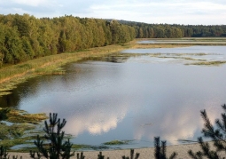
Nad Tanwią Nature Reserve - Solska Forest Landscape Park
No weather data
0.0 /5
Number of ratings: 0
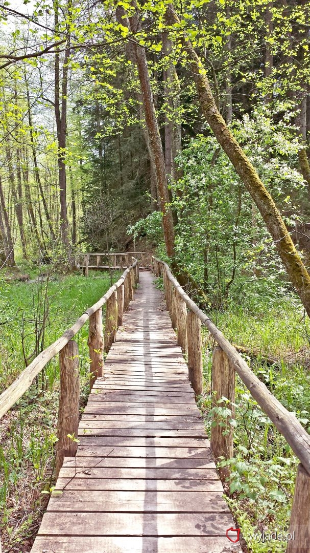
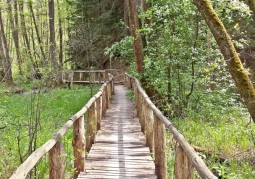
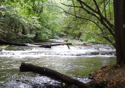
The "Nad Tanwią" reserve was established in 1958 with an area of about 41 ha. It is located in the commune of Susiec. The reserve protects the most beautiful fragments of the Jeleń and Tanew river valleys together with series of small waterfalls. At the Tanwi bend in Rebizanty, there are 24 frets over the 400 m section. They have a regular location, usually along straight lines. The reserve is located at an altitude of approx. 235 m, and the highest hill - the Church (also known as the Castle) reaches 246m above sea level. An extremely interesting vegetation grows in the reserve. About 40 plant associations were found. Of the rare and protected plants here are: juniper forkfish, coral free and alpine currant. Rare birds also live here: black stork, mountain wagtail and kingfisher. The nature reserve 'Nad Tanwią' was passed through the reserve. We reach the reserve with yellow markings of the Southern Trail or the blue Trail of the Szumów Trail.

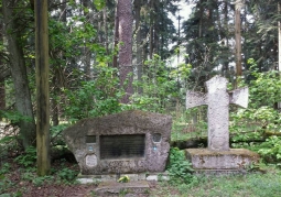
Church-Zamczysko
Category: MonumentsHill The church also called the Castle is a hill situated in the forks of the Tanwia and Jelenia valleys. It is overgrown with a mixed forest and surrounded by a rampart of a stronghold, which dates from the 12th - 13th...
Komentarze
No results
Nearby places
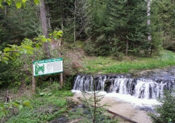
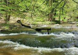
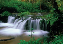
Waterfall on the Jeleń River - Solska Forest Landscape Park
Category: Lakes, springs, waterfallsThe inanimate nature monument located on the 4km section of the river within the commune of Susiec, is the largest rock threshold within the Roztocze edge zone. The Jelenia Valley, which flows through the river, was...
1 km
Church-Zamczysko - Nad Tanwią Nature Reserve - Solska Forest Landscape Park
Category: MonumentsHill The church also called the Castle is a hill situated in the forks of the Tanwia and Jelenia valleys. It is overgrown with a mixed forest and surrounded by a rampart of a stronghold, which dates from the 12th - 13th...
2 km
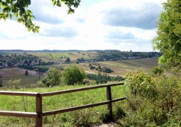
Bukowa Góra - Roztoczański National Park
Category: LookoutsA hill in Central Roztocze, located within the Strict Protection Area of Bukowa Góra, in the Roztoczański National Park. It is an interesting vantage point to the nearby picturesque areas of Central Roztocze....
28 km
Echo ponds - Roztoczański National Park
Category: Lakes, springs, waterfallsThe pond complex located in the Roztoczański National Park was founded in 1929-1934. It surrounds the area of vast wetlands of the Świerszcz stream basin. It was significantly expanded during the Nazi...
28 km

Nearby places
Waterfall on the Jeleń River - Solska Forest Landscape Park
Category: Lakes, springs, waterfallsThe inanimate nature monument located on the 4km section of the river within the commune of Susiec, is the largest rock threshold within the Roztocze edge zone. The Jelenia Valley, which flows through the river, was...
1 km
Church-Zamczysko - Nad Tanwią Nature Reserve - Solska Forest Landscape Park
Category: MonumentsHill The church also called the Castle is a hill situated in the forks of the Tanwia and Jelenia valleys. It is overgrown with a mixed forest and surrounded by a rampart of a stronghold, which dates from the 12th - 13th...
2 km
Bukowa Góra - Roztoczański National Park
Category: LookoutsA hill in Central Roztocze, located within the Strict Protection Area of Bukowa Góra, in the Roztoczański National Park. It is an interesting vantage point to the nearby picturesque areas of Central Roztocze....
28 km
Echo ponds - Roztoczański National Park
Category: Lakes, springs, waterfallsThe pond complex located in the Roztoczański National Park was founded in 1929-1934. It surrounds the area of vast wetlands of the Świerszcz stream basin. It was significantly expanded during the Nazi...
28 km